
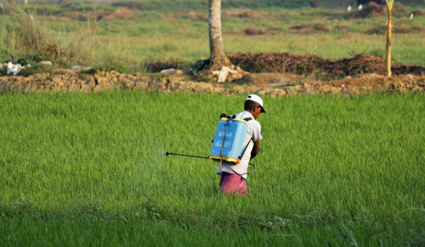
Between 2015 and 2021, India lost 83.8 million acres to floods and excess rain, and 86.5 million acres to drought. For a country where agriculture employs between 40% and 50% of the entire workforce and feeds over a billion people, those numbers represent an accelerating crisis with no clean policy solution in sight.
Meha Jain, an associate professor of geospatial data sciences and food systems at the University of Michigan, has spent nearly two decades trying to change that. Her approach is methodologically distinct: she combines direct field interviews with smallholder farmers with satellite-based remote sensing to translate individual ground-level experiences into regional and national-scale data.
The Problem With Small Farms and Big Data
India’s agricultural sector is dominated by smallholder farmers whose plots are scattered and highly varied across the subcontinent. That fragmentation creates a data problem. Farms differ in soil type, water access, crop choice, and local weather exposure, making it difficult for policymakers to design interventions that actually fit conditions on the ground.
Jain’s research directly targets this gap. From 2021 to 2023, she drew on historical groundwater availability data and insights gathered from working directly with farmers to map how cropping patterns are shifting under a warming climate. The goal is to take those rich, specific, human accounts and scale them up using satellite imagery to a level where they can actually inform national agricultural policy.
“I just realized more and more that humans can’t be considered to be separate from the environment,” Jain said.
Field Work as the Foundation
Jain’s entry into this research area came from time spent on the ground in India. A year working directly with smallholder farmers shaped the questions she has pursued ever since.
“Seeing how important agriculture was for daily livelihoods, and how uncertain and precarious agriculture had become in these times, it just made me feel very passionate about working on this issue,” she said.
That fieldwork informed her decision to learn remote sensing techniques, allowing her to scale what she observed in individual conversations to patterns visible across entire regions. The combination of qualitative farmer insight and quantitative satellite data is central to her methodology.
Recognition and What Comes Next
Jain recently received the inaugural ASU-Science Prize for Transformational Impact, an award recognizing research that advances knowledge while making a measurable contribution to society. The recognition reflects growing institutional interest in research that bridges scientific rigor and real-world policy application.
Her current focus is on making smallholder agriculture more resilient and sustainable in the face of unpredictable weather. Scaling farmer-level insights through remote sensing tools is the mechanism. Better-informed climate adaptation policy is the intended output.
With climate-linked weather extremes intensifying across South Asia, the pressure on India’s agricultural systems is unlikely to ease. Jain’s work represents one of the more concrete attempts to build the evidentiary foundation that climate-adaptive agricultural policy will require.
This article is a curated summary based on third-party sources. Source: Read the original article