Landsat 9 has been quietly redefining what satellite Earth observation can accomplish since its launch in 2021. The latest mission in a program that began over five decades ago, Landsat 9 carries forward a legacy of continuous land surface monitoring while introducing meaningful technical improvements that expand what scientists and communities can actually do with the data.
The program itself is a partnership between NASA and the U.S. Geological Survey, dating back to the launch of Landsat 1 in 1972. That first satellite started a chain of eight missions, each building incrementally on its predecessor. Landsat 9 represents the current endpoint of that chain — not a departure from what came before, but a refined continuation.
Working in tandem with Landsat 8, the two satellites together collect nearly 1,500 scenes per day, producing a complete map of Earth’s land surface every eight days. That rhythm matters. Repeated coverage of the same locations allows scientists to track seasonal crop changes, wildfire spread, storm damage, glacial retreat, and coastal shifts with a consistency that single-pass imaging cannot provide. Landsat 9 alone collects as many scenes daily as Landsats 5 and 7 combined.
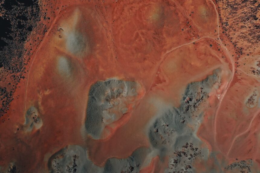
Beyond volume, the satellite delivers improved image quality through an upgraded radiometric resolution. Where Landsat 8 operated at 12-bit resolution, Landsat 9 works at 14-bit — a fourfold increase in tonal sensitivity. The practical effect is particularly significant over bright surfaces like snow and ice, where subtle variations in reflectance can indicate shifts in ice extent, surface albedo, or the formation of glacial lakes. Details that previously fell below the detection threshold become visible.
Alongside sharper tonal range, Landsat 9 delivers an improved signal-to-noise ratio. This matters most over dark surfaces such as open water, where the satellite’s enhanced sensitivity enables more reliable detection of harmful algal blooms. These blooms can develop rapidly and pose risks to drinking water supplies, wildlife, and human health. More precise early detection gives communities and scientists a clearer basis for response.
One capability that sets Landsat 9 apart from earlier missions is its ability to collect thermal data in darkness. Its onboard Thermal Infrared Sensor measures surface heat regardless of sunlight, enabling nighttime monitoring of urban heat islands, volcanic activity, and water temperatures. Since 2022, this capability has been formally applied to polar regions through the U.S. Geological Survey’s Landsat Extended Acquisition of the Poles program, known as LEAP. At high latitudes, the sun can remain below the horizon for up to six months. LEAP allows year-round thermal imaging of these regions, helping scientists track meltwater, ice fractures, calving events, and sea ice changes even during the long polar night.
Landsat 9’s data is also being fused with imagery from the European Space Agency’s Sentinel-2 satellites, enabling near-daily global observations at higher combined resolution than either system achieves independently. That integration extends the reach of what the Landsat record can support.
The program’s core value has always rested on continuity — the same careful, consistent observation repeated over decades. Landsat 9 preserves that continuity while adding the technical depth to see more clearly, more often, and in conditions where previous missions simply could not look.
Photo by Jupiter Union on Unsplash
Source: Original reporting